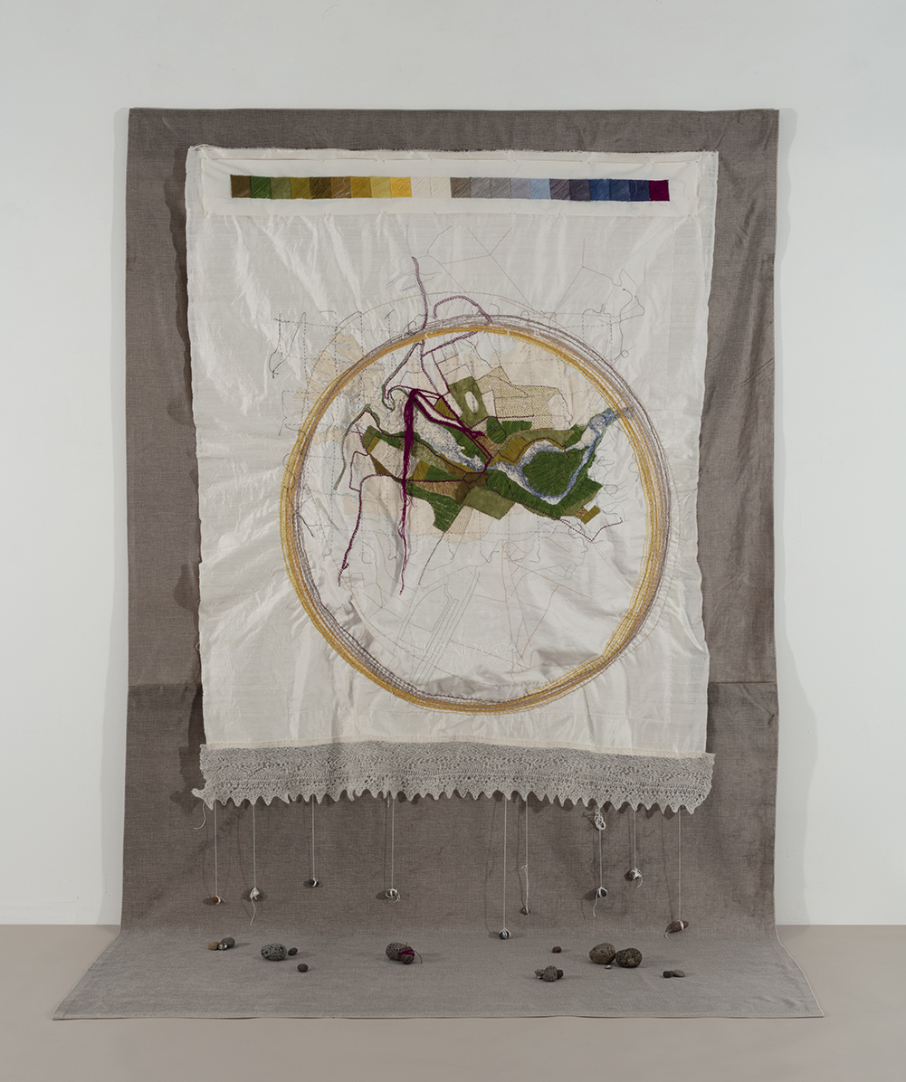
Iceland: Earth and Sky is a textile map that uses layering of translucent cloth and digital and hand embroidery to explore how we understand and represent space and mobility, our own and our earth’s. I work extensively with the trope of the map, cognizant that maps are interpretations of terrain and are vested with questions of representation, power and place. For this project, I drew on digital and analogue sources including Google Maps, recent surveyors’ maps, historical and archival pieces and local sketches, all of which evoke an abstracted truth which I juxtapose with material representations of my lived experience of the place. This project was initiated during a one-month artist’s residency at the Icelandic Textile Center (Textílsetur) in Blöndúos, Iceland, during the month of June 2016.
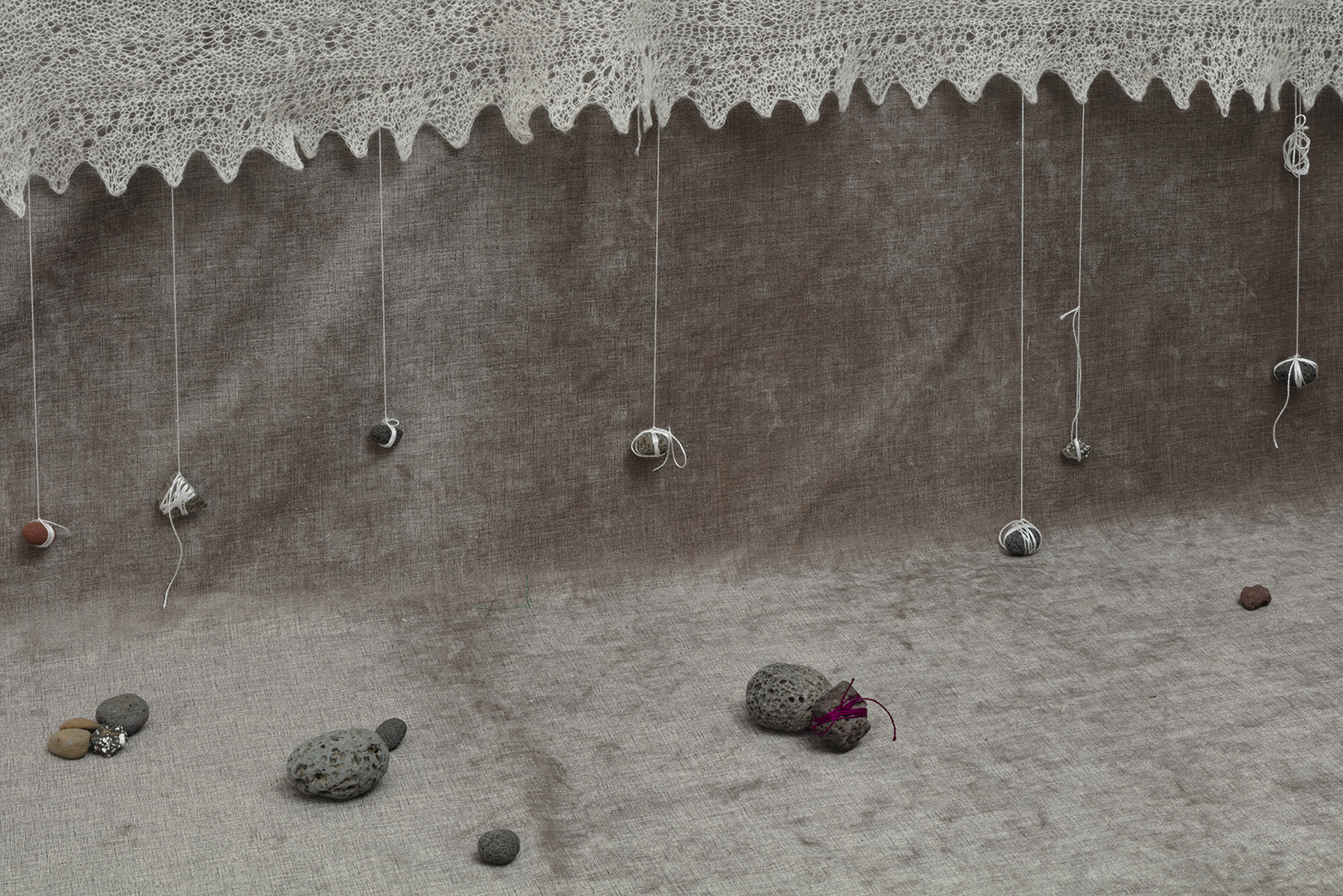
Iceland: Earth and Sky questions ways we understand space and time through digital measurement – integrating maps of two different scales, marked with the increments of latitude and longitude, as well as time markers for sunrise and sunset, which signal the earth’s rotation – and personal experience, particularly the sensory, material experiences of walking and making. Bringing together earth and sky, I represent my own walking routes in deep red-purple as well as the movements of the sun in the sky, through June’s 30 days. I work with locally sourced materials, Icelandic wool and yarns stitching into layers of silk and a bottom border of Icelandic knitted lace. A register of colours along the top of the map abstracts a spectrum from the spring tones of North West Iceland, colours that feature in my representation of the terrains of Blönduós’s centre.
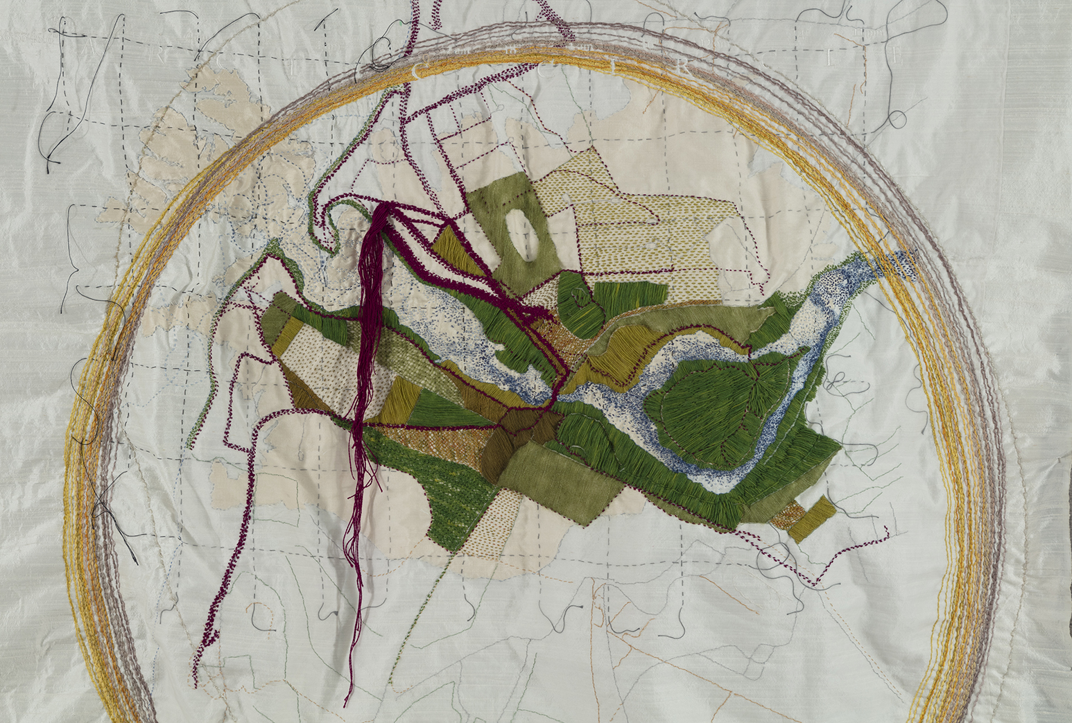
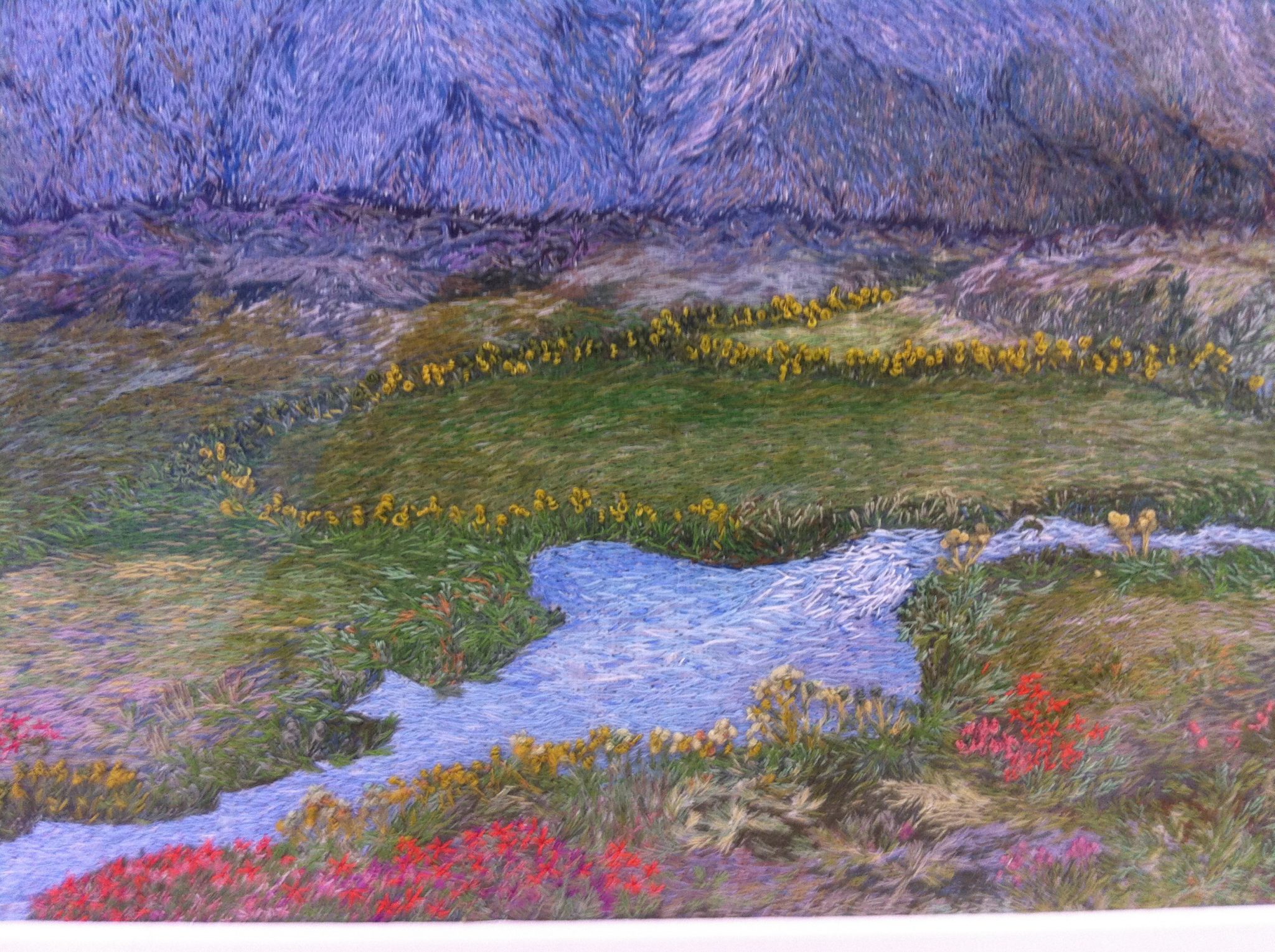
At that time of the summer solstice, the location of Blöndúos very close to the Arctic Circle means that it experiences close to 24-hour daylight, so although the sun moves through the sky, it never sets. Each of thirty endless summer days, I walked the streets, paths, fields and hills of this remote northwestern Icelandic community, coming to know the place from its feel under my feet, the rush of the wind in my ears and the scents of the sea, locally proliferating Angelica and lupine flowers, and the ever-present horses and sheep. My work is inspired by Iceland itself, as I experienced it. This short video, shot on Hrútey Island (seen as the tear-shaped green space in the middle of the blue Blanda River, in the two images above of my stitched map), aims to share some of the glories of the North West Icelandic ecosystem. The video was created on June 27, 2016.
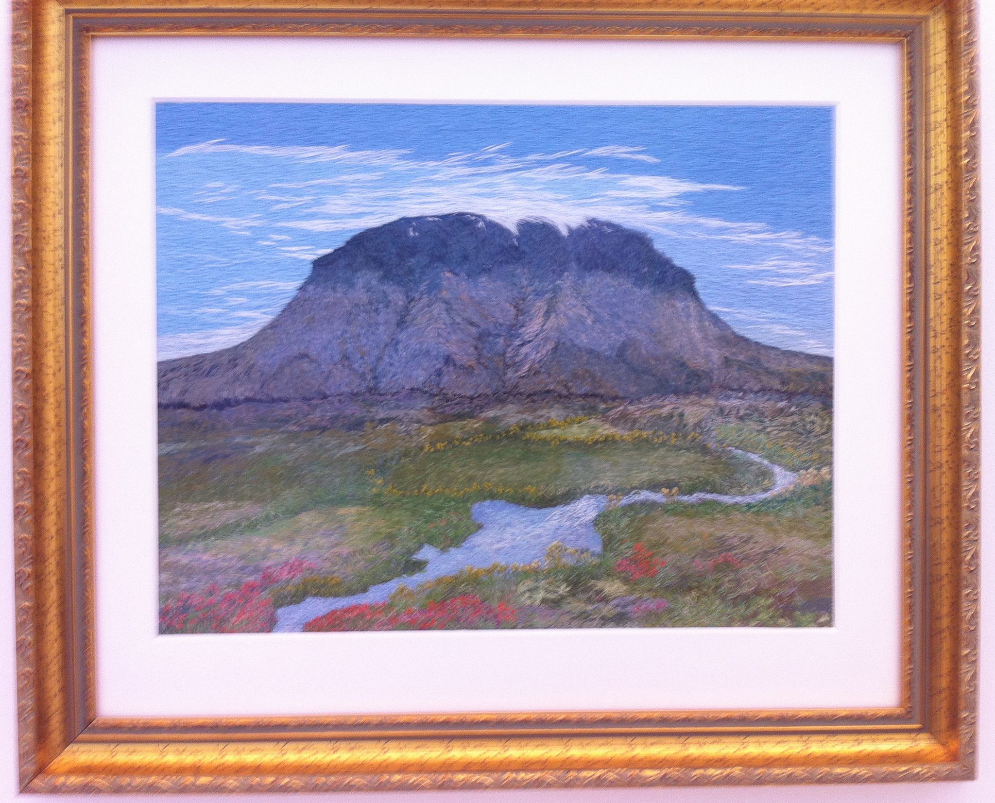
I am also moved and influenced by Iceland’s textile traditions, beautifully displayed at the Textile Museum in Blönduós, such as this (2004) embroidered work by Gu∂ru∂i B. Helgadóttir, Her∂urbrei∂. The detail reveals the masterly use of small stitches to create a dense, pictorial and material interpretation of an Icelandic landmark.
I have been writing about my art-making about Iceland in publications such as TIOnline, which features my article “My map of earth includes the sun” and the latest edition of Relate North.